Oregon
Black Rock Desert
Black Rock Desert
Pyramid Lake
Bonneville Salt Flats
Silver Island Mountains
Nine Mile Canyon
Green River Valley
Goblin Valley & Mines
Pictographs & Sego
Yellow Cat Rd. & Arches
Moab Slickrock
Lion's Back
Southeast Utah
Hall's Crossing
Hole in the Rock
Glen Canyon
Bryce & Coral Pink
Grafton Ghost Town
Arizona
Albuquerque
Ballooning
Roswell & Carlsbad
Carlsbad & White Sands
Mexican Border
Missile & Biosphere
Road to Las Vegas
Death Valley
Trip Route Map
Dashboard Computer & GPS, version 1.0
Panoramas
July 15 - Bonneville Salt Flats
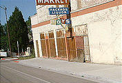
Sunday morning, I filled up in Ely and headed north along Nevada Route 93 (through one of many dying small towns pictured below). After driving for 20 miles, I suddenly remembered I'd forgotten to pay for my gas back at Ely! The gas station wasn't a "pay first" — I'd gotten out of the habit of paying for gas after pumping, spending my life living in big cities. Anyway, there was a U-turn and a 40-mile detour back to Ely before I made any further progress that day.
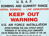
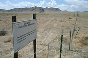
Just before crossing into Utah at Wendover, I passed one of the
many enormous off-limits bombing ranges I'd see on my trip. This one
was the ~750 sq. mi. Wendover Air Force Range.


 40.4847, -114.1431
saltflats
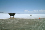
The Bonneville Speedway is at the end of a paved road that goes about 5 miles out onto the salt flats, and just dead-ends — no buildings or other permanent structures other than a sign, and a single line of orange cones heading northeast out into the salt flats. A steady stream of tourists in their rental cars and minivans came and went — speeding off into the white vastness. A tow truck was parked at the edge of the pavement — waiting for what?
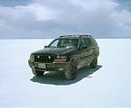
The cones extend for about 10 in a straight line miles out into the Bonneville Salt Flats, inviting me to determine the top speed of my vehicle. (My Jeep is computer speed-limited to 114 MPH.) It's a good idea to stay near the cones, as the rest of the salt flats are a bit "slushy".
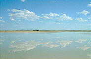
There are various "islands" that rise up out of the salt flats,
including the Silver Island Mountains that parallel the speedway to the
northwest, and the tiny Floating Island.


 40.9010, -113.6510
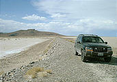
That night, I camped at the end of a trail into a nook on the
southern tip of Floating Island.


 40.8972, -113.6465

