Oregon
Black Rock Desert
Black Rock Desert
Pyramid Lake
Bonneville Salt Flats
Silver Island Mountains
Nine Mile Canyon
Green River Valley
Goblin Valley & Mines
Pictographs & Sego
Yellow Cat Rd. & Arches
Moab Slickrock
Lion's Back
Southeast Utah
Hall's Crossing
Hole in the Rock
Glen Canyon
Bryce & Coral Pink
Grafton Ghost Town
Arizona
Albuquerque
Ballooning
Roswell & Carlsbad
Carlsbad & White Sands
Mexican Border
Missile & Biosphere
Road to Las Vegas
Death Valley
Trip Route Map
Dashboard Computer & GPS, version 1.0
Panoramas
July 22 - Moab Slickrock Trail & Dead Horse Point
in
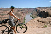
Early Sunday morning, I rode my bike around the 10 mile outer loop of Moab's famous Slickrock Trail . Unfortunately, I wasn't quite early enough.... with various mishaps including falling and smashing a connector on my Platypus water container (I resorted to tying a 2 liter soda bottle to my bike rack), I didn't get going until past 8 am. As the temperatures soared past 100°F; by 10 am, I found myself consuming the last of the total of 3 liters of water I was carrying, and getting dehydrated with a couple miles left to go. The trail, while packed with people earlier in the morning, was completely deserted when I finally got back to my car.
While it was an exhilarating workout (for my body & my bike's suspension), I found the Slickrock Trail very tough — going straight up and down the steep rock hill faces. (The trail was originally designed for motorcycles.) Periodic white painted dashes on the rock surface marked the various routes.
In the afternoon, I drove Long Canyon Road (also known as "Pucker
Pass" for its sharp switchbacks and steep drop-offs) up out of the
Colorado River valley, and south to Dead Horse
Point


 38.4703, -109.7394
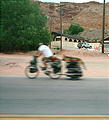
Back in Moab, I saw this guy who seemed to be touring long-distance by bicycle, pulling his large dog strapped to a trailer!


