Oregon
Black Rock Desert
Black Rock Desert
Pyramid Lake
Bonneville Salt Flats
Silver Island Mountains
Nine Mile Canyon
Green River Valley
Goblin Valley & Mines
Pictographs & Sego
Yellow Cat Rd. & Arches
Moab Slickrock
Lion's Back
Southeast Utah
Hall's Crossing
Hole in the Rock
Glen Canyon
Bryce & Coral Pink
Grafton Ghost Town
Arizona
Albuquerque
Ballooning
Roswell & Carlsbad
Carlsbad & White Sands
Mexican Border
Missile & Biosphere
Road to Las Vegas
Death Valley
Trip Route Map
Dashboard Computer & GPS, version 1.0
Panoramas
July 10, 11 - Oregon
in
On a Tuesday morning, I started my journey, heading south into
Oregon. I first noticed the temperature exceeding 100°F as I passed
through the small town of Maupin, where Oregon 197 winds down and
crosses the Deschutes River.


 45.1766, -121.0759
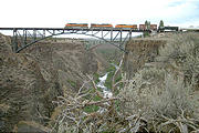
Oregon 197 later merges into Oregon 97, and then crosses the
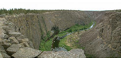
Crooked River on one of three bridges spanning a dramatic 300 ft.
gorge. The other two bridges include a railroad bridge, and the
(abandoned) old two-lane road.


 44.3900, -121.1935
I spent the night in Bend, Oregon, after having dinner at the Deschutes Brewery .
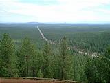
Wednesday morning, I checked out Lava
Butte
, just south of Bend.


 43.9150, -121.3500
After La Pine, I headed southeast on Oregon 31, pausing to
investigate an interesting spot I found in my DeLorme map
called "Big Hole" — basically a mile wide depression in the ground.


 43.4244, -121.3124
A little farther south, at Summer Lake, I spent a few hours trying
to find a road marked in my DeLorme map as detouring through the dunes
on the east side of the lake.


 42.9634, -120.6715
I was asked if I had any fresh fruits or vegetables. Well, I had lots — so I admitted to this. But, it turned out that they were only interested in cherries, and I had none.
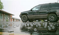
I spent the night in Alturas, California, where I discovered I had the first of what would turn out to be many flat tires. The rain produced strange bubbles on the parking lot.

