Oregon
Black Rock Desert
Black Rock Desert
Pyramid Lake
Bonneville Salt Flats
Silver Island Mountains
Nine Mile Canyon
Green River Valley
Goblin Valley & Mines
Pictographs & Sego
Yellow Cat Rd. & Arches
Moab Slickrock
Lion's Back
Southeast Utah
Hall's Crossing
Hole in the Rock
Glen Canyon
Bryce & Coral Pink
Grafton Ghost Town
Arizona
Albuquerque
Ballooning
Roswell & Carlsbad
Carlsbad & White Sands
Mexican Border
Missile & Biosphere
Road to Las Vegas
Death Valley
Trip Route Map
Dashboard Computer & GPS, version 1.0
Panoramas
July 18 - Green River Valley
in
On Wednesday, I decided to try to make my route into a loop by
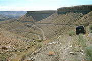
following a rough track my map showed down into the Green River canyon,
and north past the mouth of the Minnie Maude Creek. 

 39.8316, -109.8783
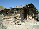
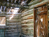
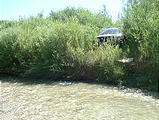
The route turned out to be very rough, but I eventually made it down to bottom at a place called Nutters Hole where Minnie Maude creek (which runs through Nine Mile canyon) meets the Green River. There, I found a couple well-preserved cabins hidden in the thick overgrown sagebrush. But right before I thought I was about to get back to the main road at Sand Wash, I found that the bridge crossing Minnie Maude Creek was missing! (I found plenty of mosquitoes, though...) So, it turned out that I had to backtrack all the way back up the hill to Horse Bench, and into Nine Mile Canyon.
Thanks to Russ Wimmer for this story of the missing bridge at the mouth of the Minnie Maude Creek:
I learned to hunt deer on Horse Bench, starting when I was about in the seventh grade. My cousins started to take me down there to hunt. My Uncle Harold (who was the more colorful member of our family) had been hunting deer there since the 1940's. [...]
Where Minnie Maude creek empties into the Green River, at the Mouth of Nine Mile Canyon, is called Nutters Hole. It is privately held land that was at one time part of the vast holdings of the Preston Nutter Corporation. The Preston Nutter Corp. was sold to Sabine Oil in the early eighties and has been sold many times (among oil companies) for its tar sand value. (I believe Hunt Oil Co. owns it now.) Back in the thirties, Preston Nutter would send his men to the lower end of the canyon in the early summer to put up hay. The two cabins you have pictured were built for the hay crew to stay in. The hay crews built the bridge as well. As I was told it was just a wooden plank structure.
This brings me back to deer hunting. My Uncle was the avid hunter of the family and sometime in the fifties he headed down to the end of Nine Mile Canyon with his "hunting" party, most likely consisting of my father, aunts and cousins. at the locked gate in the bottom of Nine Mile Canyon, they would have turned north and headed up Franks' Canyon to reach what we call the "Wrinkle Road" upon reaching this, they would have turned right and head east along the east side of Nine Mile Canyon. The "Wrinkle Road" covers much of the same type country you did on Horse Bench. As I was told, they reached the river about noon. The bridge was washed out and had swung around downstream. Well, Uncle Harold (being the arsonist he was at heart) decided if it was noon, it was time for lunch, and they should have a fire. There is a lack of firewood in that area. The way I heard it, he took a crow bar and pulled the bride apart and used it for firewood. That was the demise of the bridge over Minnie Maude creek.
I was born in 1964 and didn't see the "river" till I was about eight years old, and went fishing for catfish on the Green River (with the same Uncle). There was no bridge then and I think that was when that story was related to me. I know it took a lot of shoveling to make the crossing passable.


