Laguna Salada
My original plan was to explore Laguna Salada by driving on the dry lake bed (playa) surface — but it did not turn out to be dry. Instead, I headed south on the dirt road along the west side of Laguna Salada, which starts at a place called Ejido Luchadores del Desierto ("Fighters of the Desert"). 

 32.5719, -115.7943
I stopped at a rocky "island" in the lake bed to survey the area. There were quite a few offroading vehicles at the north end of Laguna Salada. 

 32.4584, -115.7919
I decided to try a detour east back onto the lake bed to test its surface, but the main route was still impassibly wet.
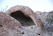
Continuing south, I stopped to camp at some rocks near Guadalupe Canyon Hot Springs to see if I could find some of the rock art that was marked on my map . I never did find any petroglyphs that evening, but I did have fun climbing on the rocks, investigating countless holes and caves.
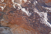
The next day, I tried following what looked like the most popular tire tracks in the sand, and they lead me to a canyon with a seeping spring, palm trees, and some rock art! There I also found a grinding hole. I'm told there are many other nearby petroglyph and pictograph areas, but at least I found one site!
An olive tree plantation at the Cañon Guadalupe road turn-off — lots of very dry olives on the sand. 

 32.2014, -115.7099
An abandoned vineyard 

 32.1327, -115.6356
I tried to find a road heading east, over to Highway 5, but ended up on a bumpy race trail instead. 

 32.0085, -115.4986
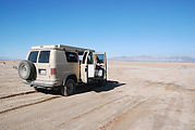
A lunch break before heading north and east over the lake bed, with mud that was only partially dry. 

 32.0630, -115.4263
By mid-afternoon, I made it to Highway 5! Heading south towards San Felipe, I passed through my first of many military checkpoints on this trip.


