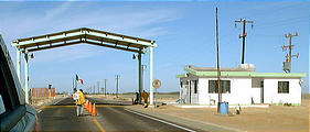
Driving & Military Checkpoints
Roads
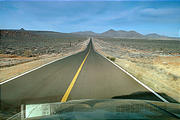
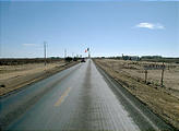
There is one paved two-lane road that runs the full length of the Baja Peninsula. This road is in decent shape, but there are no shoulders — the drop-offs at the road's edges are steep enough that if an inattentive driver accidentally veers slightly off the road, there will probably be damage to the underside of the car.
There are a handful of spur roads to various other places, but many of these are only "mostly paved" — and sometimes the fraction of road covered by deep potholes creeps dangerously close to 50%. The main roads to all other places are gravel (usually badly washboarded) or dirt tracks.
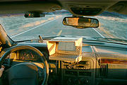
I used a GPS connected to my notebook computer to display a map with my current location. I scanned in all the maps in Landon Crumpton's Baja Almanac , and displayed these using OziExplorer software.
Military Checkpoints
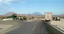
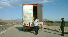
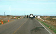
I'd encountered a military checkpoint once before on a previous trip into Baja Mexico, but there seemed to be many more than usual this time. During my 9 days in Mexico, I encountered somewhere between 10 and 15 military checkpoints.
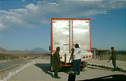
These checkpoints are manned by bored but friendly young men with large guns, who make a cursory inspection of every vehicle passing along the road — looking for drugs. Perhaps they will look in the glovebox, open the back doors, or maybe poke the underside of the car in a few places with a screwdriver. But, the process is very quick, and not intimidating. Sometimes they were curious about the computer mounted on my dashboard. Often the soldiers offered to buy something in my car, like my bicycle or electric shaver. ("¡No, tengo solo uno!")
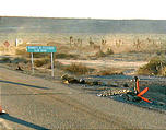
Occasionally, one soldier's job would be to stand farther up the road holding a string attached to a board with spikes that could be pulled onto the pavement to stop a fleeing vehicle.
As I approached Guerrero Negro, the enormous Mexican flag flying at the border between the states of Baja
California and Baja California Sur at the 28th parallel could be seen from miles
away. 
 28.0049, -114.0120

