Bonneville Salt Flats
In early October of 2005, we went on a two week tour of southeast Utah. Geoff had explored many of the same areas four years earlier and was excited to revisit and share some of his favorite places. Laura had also fallen in love with southeast Utah when she was in middle school but hadn't been back since. October seemed like a great time to visit as the weather was usually dry and cooler, allowing for mid-day exploratory hikes which would not be as pleasant in the heat of summer.
We took a day and a half to drive from our home in Seattle, WA to the Utah border, taking highway I-84 through Washington, Oregon and Idaho. We camped one night on a small backroad near Lookout Mountain on the Oregon side of the Oregon/Idaho border — getting to bed in the dark and rising way before sunrise. We never saw the surrounding environs, but did hear a pack of coyotes yelping and crying in the night — reminding us that our trip really had begun. We were no longer home in the city.
We made it to the Utah mid-day, entering through the town of Wendover, which is split by the Nevada/Utah border. We were met with numerous gambling establishments, all on the Nevada side.
Salt Flats
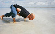
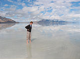
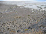
Our first stop in Utah was the surreal Bonneville Salt Flats. Geoff was excited to drive on the salt flats, like he had before , but this time we found them covered with a couple inches of water. This created for a very different and surreal experience. It seemed as if the land and lake had no beginning or end.
Floating Island
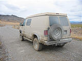
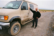
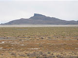
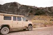
From here, we headed out to Floating Island, a hill which (with all the water) really lived up to its name. There is a dirt/gravel road which circles the Silver Island Mountains which is to the northwest of the Bonneville speedway area. Floating Island "floats" just to the east of this Range. We took the eastern side of the Silver Island loop, in hopes of finding the road which Geoff had taken out to Floating Island on his last visit. But with all the rain that had fallen a day or so earlier, we were slipping and sliding along the road, as if it were ice. The van was quickly coated in mud.
We were successful in finding the road to Floating Island, and camped for the night on its eastern side. Geoff remembered a hilltop cave from his past travels - one that Terry Tempest Williams seems to mention in her book Refuge , which we were reading as we drove. We had several more hours of daylight so we packed some water and started on a search for the cave by foot. After traveling up and down some ridges, he realized that the cave must be significantly further than Geoff had thought. We decided to try again the next day, and instead we explored a small mining cave, and then continued to climb up to the top of the "Island".
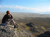
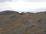
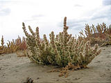
If you look at the image of Floating Island, you will see several flat plateaus. These impressions were created by the former Lake Bonneville , when its shore was at a significantly higher elevation. We reached the top layer and found the plateau to be wide and flat enough that one could drive a car around up there if it were helicoptered in. There were pools of water, and some vegetation was growing — not quite what we would have expected in this desert! We were also surprised to see how far we had ended up were from our van. At this point the sun was setting, and it was time to head down. This was the first in many of our explorations where we could climb to a high point, see a distant destination and create our route there by sight. This is quite a different experience for us Northwesterners who are used to being lost in lush undergrowth and trees.
Hilltop cave
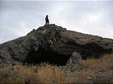
We headed out the next morning to again look for Geoff's cave, and this time found it fairly easily. We remembered what Terry Tempest Williams had said in her book:
Put aside any romantic or spiritual notions of ancient desert people," said Kevin Jones, an archaeologist, as we walked out to Floating Island in the middle of the salt flats. "Believe me, there was no romance in people's lives ten thousand years ago. The pretty much acted as we would — assessing their situation and making decisions based on the choices at hand."
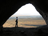
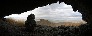
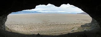
We hiked up the hill to the cave. Floating Island is an isolated outcrop of limestone separated from the Silver Island Mountains by at least a mile of salt flats. The cave measures ten meters across its mouth, twelve meters deep. It looks over the West Desert with Great Salt Lake lapping east.
[...] think about the Fremont, desert people who inhabited the eastern Great Basin and western Colorado Plateau from approximately 650 to 1250 A.D., roughly a thousand years ago. They planted corn, irrigated their fields, and used wild foods with ingenuity. In many ways, the Fremont correspond to the Anasazi to the south. But in many ways, they do not. The Anasazi were a group of people attached to the Colorado Plateau with a complex social organization: clans, elaborate kivas, and road systems. In contrast, the Fremont were small bands of people, much more closely tied to their immediate environment. They were flexible, adaptive and diverse.
Floating Island Cave looks out over Great Salt Lake. A deeply layered cave site helps archaeologists to interpret Fremont groups in two important ways. First, deposits at the sites represent repeated visits by hunting and gathering groups from more than ten thousand years ago to less than fifty years ago. The numerous caves in the limestone mountains of the Great Basin provided natural shelters and storage facilities for the hunter-gatherers who inhabited this region."
Refuge: An Unnatural History of Family and Place by Terry Tempest Williams, pp. 179-181
The weather was quite different from the day before — it was a bit windy and cold for hanging around outside — so we soon clambered down to the van and were back on the road heading counterclockwise around the Silver Island Mountains.
After crossing the Donner-Reed Pass, we came across a large cave in the west side of the mountains. We imagined what it must have been like to live there so many years ago — both for the ancient people who lived in the caves as well as the pioneers (which the pass was named) who traveled across this desolate area.
Heading East
Around mid-day we returned to pavement, and started zooming east on I-80 towards Salt Lake City — just next door on the map, but yet over a hundred miles away. For most of the way, there are no towns, just some rest areas which warn of snakes and scorpions.
We picked up a few provisions in the city — stuff we had forgotten to pack. Dollar stores are the best places to find the little things for cheap: 29¢ mugs, and a frying pan lid without having to buy the pan too. After a quick stop at a hotel advertising "free WiFi" (where we checked our email from the parking lot while sitting inconspicuously in our huge muddy van) we were on our way again.
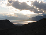
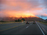
Rush hour traffic was horrible but we were rewarded with a gorgeous sunset on the low lying clouds and mountains before we headed off of the highway. And we were about to run into... snow!


