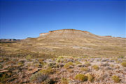
Horse Bench over Green River
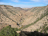
Our ultimate goal was to head towards Horse Bench, a place with gorgeous vistas of the Green River. To get there from Nine Mile Canyon, we took Cottonwood Canyon southwest, climbed a steep set of switchbacks up to Sage Brush Flat, and headed east past an airfield and onto some challenging ridge trails on Rock House Bench, and finally arrived on the flat Horse Bench. There was lots of evidence of industry in the Cottonwood Canyon and Sage Brush Flat area, with pipelines and a constant presence of various trucks marked "Halliburton". The time was around five o'clock and it seemed as if work was just let out, as white truck after white truck passed us heading out of the area.
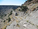
Once we left this "main" graded dirt road in Halliburton country, we were on our own. Our road was much bumpier, and we found ourselves in four-wheel drive low much of the time, driving along narrow roads on cliff faces or maneuvering around pointy rocks as we headed towards Horse Bench.
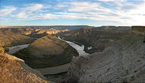
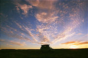
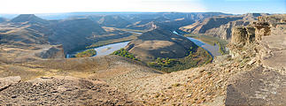
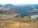
Once we arrived on Horse Bench itself, we traveled for miles to the far east edge before coming across the fabulous cliff top view of Green River. As we arrived near sunset, we were blessed with gorgeous red lighting and the sliver of a setting moon. We fell asleep with dreams of further exploration in the morning.
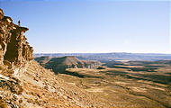
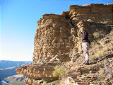
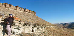
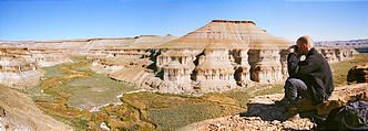
When the sun rose, we were up early to explore by foot the land in the Green River canyon below us (just south of the "Nutter's Hole" area). For as far as we could see, there was no one around. To climb down, we found an eroded break in the cliff face, and decided it seemed reasonable to scramble down to the plateau below. As we started down the rocky outcroppings, we found ourselves stopping practically every few feet to take photographs — the vista, the way the rocks crumbled, the striations - it was all so beautiful!
We clambered easily to the flatlands below and tried to stay somewhat close to the edge (yes, keeping safety in mind, mother!) to keep the Green River in view. We hoped the ancient cracked boulders we were standing on wouldn't decided today was the day to separate from the cliffs and plummet with us!
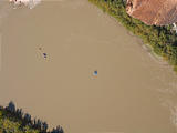
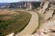
As we stood at the south edge, looking down roughly 600 ft. upon a huge U in the Green River, there was so much we could see. And we could faintly hear voices! With closer inspection through our binoculars, we found that we weren't the only ones around. There was a small group of boaters, little colored dots camped out on a beach far below. We sat and spied on them for a while as they ran around camp and made their breakfast.
From here, we hiked over to the north side of our plateau, to look at where the Nine Mile Creek (coming out of the canyon where we had spent the day before) merged with the Green River. The creek was much smaller, the bubbling water winding tightly, the shores lush with bushes and rushes. Quite a different scene from the slowly moving wide water of the Green River. We sat and watched, meditated and wrote, as we looked out over this gorgeous scene.
Our trek across this area was also our introduction to "cryptobiotic soil", a puffy two inch layer of soil full of living bacteria, algae, lichens and moss. We're told that if you squish it with your foot (or tire), it takes years to recover. Here, as with many places later on our trip, we found it tricky to walk cross-country, trying to stay on rocks or in washes so as to not step on this nutrient rich soil.
On our way back up again to our van, we paused to see how our boating friends were doing. By then, they were on their way. We spied them drifting slowly down the river, lazily rotating, like water bugs with their paddles and pontoons. But this time they spotted us as well! We wondered what they though of us, two hikers in the desert in the middle of nowhere. We waved to them and they waved back and we were on our way.
After a quick lunch, we decided to keep moving and started out long drive back out.
As we were now considerably more comfortable with driving our van on narrow trails with steep drop-offs, we stopped frequently to take videos and photos of Geoff driving over this challenging terrain.
We took Dry Canyon Road back out to East Carbon (near Highway 6) and camped just off of a side road for the night. Our plan was to hit Goblin Valley at sunrise the next day, and we wanted to be able to quickly get up and go the next morning.

