La Mora & Alamar Canyons
Cañon La Mora
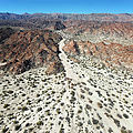
I explored La Mora canyon, which doesn't seem to have any spring water to support palm trees. I was able to drive up
the wash to 

 32.0251, -115.7227
I spotted a ribbon tied to a bush. And then another. Those led me to a series of cairns - which eventually took me to a group of rocks on the north side of the canyon. I found a curious hollow in the rocks under a tree. I wonder what was going on here...?
Cañon Alamar
Access to this canyon is blocked by a fence across the wash. It might be possible to get up the canyon by going through
the ranch at 

 32.0086, -115.7071

 32.0100, -115.6976


