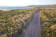
Bahía Concepción East Side

Punta Concepción and Sierra los Gavilanes

Next, I made my way south to Bahía Concepción. For a long time I've wanted to explore the peninsula on east side of this bay, and the mountains Sierra los Gavilanes.

First I passed the fishing camp of Arroyo Luis. The beach here (along with almost all the beaches on this east shore) is pebbly. The water was silty dark brown. See in Google Maps  See in Google Earth   26.5887, -111.6769 

Bahia Concepcion - East Side - Sierra los Gavilanes - Arroyo el Mono - Beach Bahia Concepcion - East Side - Sierra los Gavilanes - Arroyo Luis - Fish Camp

Arroyo los Pintados

I wandered inland to explore Arroyo los Pintados. Sure enough, it is painted! After parking at end of the driveable wash, I hiked a half mile farther up the canyon and spotted lots of pictographs.

Sierra los Gavilanes - Arroyo los Pintados - Canyon Sierra los Gavilanes - Arroyo los Pintados - Pictographs Sierra los Gavilanes - Arroyo los Pintados - Pictographs Sierra los Gavilanes - Arroyo los Pintados - Pictographs Sierra los Gavilanes - Arroyo los Pintados - Pictographs - Handprints Sierra los Gavilanes - Arroyo los Pintados - Pictographs Sierra los Gavilanes - Arroyo los Pintados - Pictographs Sierra los Gavilanes - Arroyo los Pintados - Pictographs Sierra los Gavilanes - Arroyo los Pintados - Pictographs Sierra los Gavilanes - Arroyo los Pintados - Pictographs Sierra los Gavilanes - Arroyo los Pintados - Step in Canyon

Driving North Up the Coast

I continued driving up the east side of the bay until sunset, camping on a nice (if unremarkable) section of pebbly beach. See in Google Maps  See in Google Earth   26.6247, -111.7111 

Bahia Concepcion - East Side - Sierra los Gavilanes - Road - Margarita Bahia Concepcion - East Side - Sierra los Gavilanes - Cactus - Road - Margarita Bahia Concepcion - East Side - Sierra los Gavilanes - Beach - Sunset Bahia Concepcion - East Side - Sierra los Gavilanes - Pelican Bahia Concepcion - East Side - Sierra los Gavilanes - Aerial - Beach Bahia Concepcion - East Side - Sierra los Gavilanes - Aerial - Beach Bahia Concepcion - East Side - Sierra los Gavilanes - Cactus - Punta Beatriz

About 2/3 of the way up the east shore of Bahía Concepción, the road starts getting overgrown, and finally becomes impassably washed out in places. Here, I followed tire tracks onto the shore where I found that people use the pebbly beach as the detour road. See in Google Maps  See in Google Earth   26.7978, -111.8246 

Bahia Concepcion - East Side - Sierra los Gavilanes - Road Washed Out Bahia Concepcion - East Side - Sierra los Gavilanes - Driving on the Beach

Guadalupe Fish Camp

Bahia Concepcion - East Side - Sierra los Gavilanes - Punta Guadalupe - Guadalupe Fish Camp

Punta Santo Domingo Beach

My goal was Punta Santo Domingo. At some point I had scribbled some notes in my Baja Almanac about a nice white sandy beach being out there.

Just before reaching the beach, I managed to destroy my right-front tire with a nasty unpatchable sidewall puncture. It was totally my fault. Preventable. I was tired and had recklessly started driving a bit too enthusiastically through a rocky wash. During one hard left turn, my right front tire rolled under, exposing the sidewall to a big sharp rock. Furthermore, I now believe I had my tire pressure set too low. I had aired down to 1/3 highway pressure — which I find is good for sand and pebble beaches, but this is probably too low to use in rocks. I think I should have been running my tires closer to 2/3 pressure.

As the ruptured tire was a goner anyway, I decided to just drive rest of the way the beach, rolling along for a quarter mile on my flat tire. It would be so much nicer to do my tire change on the beach! Yes, it turned out to be worth it - so much more comfortable changing a tire with a cool sea breeze rather than up in a dusty wash. However, jacking in the sand is a bit tricky, as it tends to sink in.

Bahia Concepcion - East Side - Sierra los Gavilanes - Broken Tire Sidewall Bahia Concepcion - East Side - Sierra los Gavilanes - Punta Santo Domingo - Beach - Tire Change

Here's the beach at Punta Santo Domingo. See in Google Maps  See in Google Earth   26.8646, -111.8441 

Bahia Concepcion - East Side - Sierra los Gavilanes - Punta Santo Domingo - Beach Bahia Concepcion - East Side - Sierra los Gavilanes - Punta Santo Domingo - Beach Bahia Concepcion - East Side - Sierra los Gavilanes - Punta Santo Domingo - Beach - Aerial Bahia Concepcion - East Side - Sierra los Gavilanes - Punta Santo Domingo - Beach - Aerial Bahia Concepcion - East Side - Sierra los Gavilanes - Punta Santo Domingo - Beach - Aerial

Beachcombing...

Bahia Concepcion - East Side - Sierra los Gavilanes - Punta Santo Domingo - Beach - Seashells Bahia Concepcion - East Side - Sierra los Gavilanes - Punta Santo Domingo - Beach - Seashells Bahia Concepcion - East Side - Sierra los Gavilanes - Punta Santo Domingo - Beach - Seashells Bahia Concepcion - East Side - Sierra los Gavilanes - Punta Santo Domingo - Beach - Seashells Bahia Concepcion - East Side - Sierra los Gavilanes - Punta Santo Domingo - Beach

Punta los Hornitos

A lighthouse and the fishing camp of Punta los Hornitos fishing camp are just beyond, to the north. I tried to go all the way to the end of the road, but I encountered all these rocks placed in the road. I took this as a message saying they didn't want any visitors.

Bahia Concepcion - East Side - Sierra los Gavilanes - Punta Santo Domingo - Punta Hornitos - Beach - Aerial Bahia Concepcion - East Side - Sierra los Gavilanes - Punta Santo Domingo - Los Hornitos Camp - Punta Los Hornitos Bahia Concepcion - East Side - Sierra los Gavilanes - Punta Santo Domingo - Rocks Blocking Road to Los Hornitos Camp

Gavilan Manganese Mine

The ruins of this mine are over the hills, on the northeast corner of Punta Concepción. See in Google Maps  See in Google Earth   26.8761, -111.7929 

The old water tank at the top of the hill says 1943.

Sierra los Gavilanes - Gavilan Manganese Mine - Beach Sierra los Gavilanes - Gavilan Manganese Mine Sierra los Gavilanes - Gavilan Manganese Mine - Ruins Sierra los Gavilanes - Gavilan Manganese Mine - Ruins Sierra los Gavilanes - Gavilan Manganese Mine - Ruins Sierra los Gavilanes - Gavilan Manganese Mine - Ruins Sierra los Gavilanes - Gavilan Manganese Mine - Ruins Sierra los Gavilanes - Gavilan Manganese Mine - Ruins Sierra los Gavilanes - Gavilan Manganese Mine - Ruins Sierra los Gavilanes - Gavilan Manganese Mine - Ruins

Wriggling around among the desolate gray walls and rock was this bright blue caterpillar! I've never seen anything like it, and I still haven't been able to identify it. Anyone know what this is?

Sierra los Gavilanes - Gavilan Manganese Mine - Blue Caterpillar