Sierra de Juarez
Sierra de Juarez
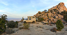
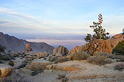
My first campsite was in Sierra de Juarez, at the very eastern edge of the plateau, where it drops down 4600 feet to Laguna Salada – a usually dry lakebed at sea level. I had picked out a spot from my research on Google Earth that I thought likely to have a good view. This location is four miles west of (and almost a mile above) "Cantú Palms" where I would go exploring the next day.
I love this high country, with its pines and junipers interspersed with giant boulder fields.
I passed a couple towers that I assumed to be antennas, but I found they were marked "wind measurement". I later read that they are part of an investigation for a plan to consider installing wind turbines in the area (the "Rumorosa Wind Project"). It certainly was windy!
I also passed one of the old airstrips I had noted in the satellite imagery. These have been destroyed by the Mexican military, using trenches to make life difficult for the drug runners who used them. 

 32.3614, -115.9034
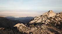
Here's the campsite, with its view east over Laguna Salada, where I would be exploring for the next few days. 

 32.3732, -115.8812
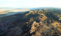
Looking northeast towards the Mexicali sprawl:


