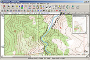
Dashboard Computer & GPS, version 2.0
On road trips I love having a notebook computer mounted on my dash for:
- GPS moving-map (for backroading and not getting lost in strange cities)
- MP3 music
- storing photos from my digital camera
- occasionally checking email at WiFi hotspots
Computer
I use a notebook computer instead of a stand-alone GPS with built-in maps, because computer mapping software shows a larger, more detailed display. I want to be able to see all the little mining and logging trails out there, as well as various points of interest (ruins, petroglyphs, hot springs, fire lookout towers, etc.). Furthermore, a computer's screen is so much better for seeing the "big picture"! A stand-alone GPS appliance is, however, much simpler to install.
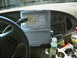
I use the smallest notebook computer I could find, so that I block as little as possible of the dashboard functionality (radio, vents, cup holders, etc.). These days, I use a circa 2009 Asus Eee PC T91MT , a tiny touchscreen notebook computer (not pictured below). In the past, I have also used a Fujitsu P1120, and a Toshiba Libretto 100CT .
Mounting
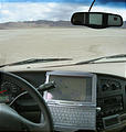
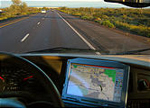
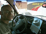
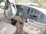
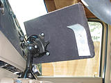
My Sportsmobile is a Ford E-350 van. I mounted the computer on the left edge of the engine-cover "hump", so that the only things blocked are two 12v outlets, and one vent. I cut and bent a custom cradle to hold the computer using thin sheet metal, to which I glued some soft cloth for protection. The cradle is mounted to the center hump by a hefty "PanaVise" ball & socket swivel mount I happened to find at a local surplus store a few years ago. (I wish I could tell you where to find one, but I don't know the model number. This PanaVise ceiling mount looks somewhat similar.) Because the swivel is not centered on the cradle, the weight of the computer plus lots of bouncing tended to gradually rotate the cradle counterclockwise. So, for support, I also added on the left side of the cradle a thin metal tab which inserts into a crease on the dashboard.
GPS
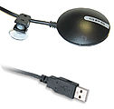
The GPS I currently use is the GlobalSat BU-353 Water-Proof USB Mouse GPS Receiver - SiRF Star III (WAAS Enabled) . I previously used a Rayming TN-200 USB GPS which I bought for $90, but it didn't work very well and died after only two years of use.
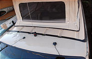
I have added 6-foot USB extension cable to give me about 12-feet total to get from the roof, down the outside edge of the windshield (tucked into the rubber moulding), and then into the hood and back into the cab behind the driver's door, and finally to my laptop computer.
Software
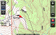
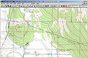
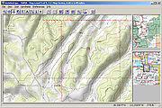
For USGS topographic maps, I'm currently using Overland Navigator , the first GPS topographic mapping software I've found with a user interface specifically designed for in-car use. Overland Navigator also has the most inexpensive maps. In the past, I used various other topographic mapping software products including National Geographic Topo! , Maptech Terrain Navigator , Delorme 3-D TopoQuads . None of these other products really stood out as vastly superior. These products show varying map quality, and each has its own quirky user interface.
For street maps, I run DeLorme Street Atlas USA and Microsoft Strets and Trips . I like the DeLorme's user interface better, so I usually use that, but only the Microsoft product has Canada coverage, so I switch to that when I'm heading north of the border.
In Mexico , I can display the government's INEGI topographic maps using OziExplorer . These maps are sold georeferenced in OziExplorer format by bicimapas.com . OziExplorer's user interface is distinctly quirky, but for now it's pretty much the best option for displaying foreign topographic maps and user-scanned paper maps. Another product worth considering is Fugawi .
Even when driving in the backcountry, I often find myself using a "streets" map product rather than a topographic one, because the maps are simpler. The DeLorme & Microsoft Streets products actually include most of the tiny mining and logging tracks anyway, and it can be easier to quickly glance down at a simple black line on a yellow background than to interpret all the visual complication of a topographic map.
Finally, I found that I can simultaneously use multiple mapping products with software to share the same GPS signal among multiple programs. The Franson GpsGate program does an excellent job of sharing the GPS signal, replicating the same serial port or USB data from the GPS as multiple virtual serial port connections for other programs to use. It also includes its own data logger. With GpsGate, I can run at the same time Overland Navigator for a topographic view and DeLorme Street Atlas USA for a "streets" view, easily switching between them by tapping on the Windows taskbar on the Fujitsu's touchscreen.

